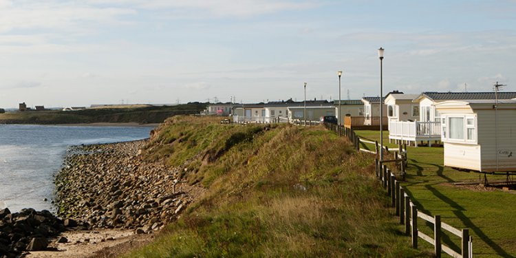
Park Newbiggin England
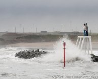
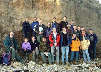 Team photograph by Dave Roberts from the Northumberland coast
Day 1
After the previous evening’s introductory talk, beers and bingo, some of the members of the party were feeling a little worse for wear. Team Leader Teasdale set a shining example: imbibing, socialising, walking into doors, but unfortunately not securing his own accommodation – preferring to spend the night instead in an unheated car. First stop 9am: the clifftops of Sandy Bay, a mere 100m from the caravan site. Derek Teasdale briefly described the geology and Quaternary history of the area whilst others examined the exposure. The presence of a thin, poorly sorted diamict atop Carboniferous sandstone appeared to indicate an ice-sheet coming from the northeast. At beach level, evidence for a stacked till sequence was examined. Dave Roberts questioned the mode of deposition for the lowest, crudely bedded, diamict unit. Could sediment have been deposited or lodged in discrete packets each one distinguished by sub-parallel horizontal cracks or fissures? Although this hypothesis was not rejected, Emrys Phillips (BGS) highlighted how these cracks could also be a function of pressure release and associated water escape during deglaciation. The group concluded that evidence for multiple tills at Sandy Bay was not overwhelming, however the model of glaciation proposed by Eyles and Sladen (1981) is almost certainly oversimplified and in need of revision.Moving south to Whitley Bay, the group examined a section of coastline near to St. Mary’s lighthouse. Here two diamicts appear to be separated by a laterally-persistent clast pavement. Striae on these clasts suggest a W-NW palaeo-ice direction. The origin of the clast pavement was discussed by Colm O’Cofaigh (Bristol), Tavi Murray (Leeds) and Wishart Mitchell. Derek Teasdale suggested that the gravel unit overlying the lower, grey-brown, diamict has been deformed by ice moving in a westerly sense. Lunch was eaten at The Briardene Inn. A discussion led by Tom Bradwell (BGS) centred around the high quality of the homemade Steak Pie and Theakston’s Black Sheep Ale.
The cliff sections at Whitburn, 10km south of Whitley Bay, were the scene of the afternoon’s congregation. A complicated stratigraphy consisting of at least five different lithofacies occurs here. Could the fracturing of the magnesium limestone bedrock be a result of glacial loading and tectonics? Probably not, thought Brian Young (BGS) - collapse breccias like these being common on this stretch of coastline. The presence of subglacial meltwater channels was highlighted by Derek Teasdale. However, Dave Evans (Glasgow) offered a competing hypothesis suggesting that the sediment assemblage could also have been the product of proglacial, ice-marginal, drainage. The occurrence of sand and gravel lenses within a weakly-stratified, matrix-supported, diamict were purported by Dave Roberts to be the result of glaciotectonism, primarily acting through ductile deformation. Emrys Phillips, who prefers to see clear evidence of deformation before a glaciotectonic model is invoked, quickly rebutted this explanation. He professed: "How can a fluid – such as pressurised, water saturated clay – deform?" A good sequence of closely-laminated fine sands and silts, with evidence of cross bedding, were highlighted by Derek Teasdale as evidence of low-energy subglacial streams and ponds. Almost all agreed that the pattern of glaciation in this area was complex and in need of further illumination.
The group reconvened at Sandy Bay in the evening. In time-honoured GLWG tradition the Saturday night entertainment was truly world class. Bingo was played in reverential, almost deathly silence. Then ‘Michelle’ took to the stage. Dressed in PVC playing to a packed audience, she performed those keyboard classics you would rather forget. One hour and two encores later, the show was over – although the memory lives on. The evening was rounded off with the obligatory disco – birthday-girl Sarah Arkley (BGS) leading the way on the dance floor.
Day 2
GLWG re-assembled at 9.30am on the beach near Amble. Small cliff sections were taken as further evidence of glacio-deformation. Some good examples of the bedrock/till contact were highlighted by Derek Teasdale and Dave Evans. Geomorphological evidence can be used to determine the spatial extent of ice-marginal fluctuations during the Last Glaciation. Crowden Hill Ridge is thought to represent one such glacial limit. Derek Teasdale asserted that this low, inconspicuous feature can be traced for over 50km and probably marks the westward extent of a North Sea ice lobe during Late Devensian times. Tom Bradwell thought the drift ridge may also be a form of medial moraine representing the confluence between the onshore and offshore arms of the British Ice sheet, as postulated by earlier workers (Smythe, 1912).At 11.30am the group assembled at Meldon Park ridge near Belsay. This cross-valley feature is marked on BGS sheet 14 as "sand and gravel", although its origin is unknown. Dave Roberts suggested that it is a terminal moraine of Lateglacial age associated with either ice moving from the west or the east. More detailed sedimentological investigations would be needed to determine the exact genesis of this conspicuous feature, in an otherwise remarkably moraine-free landscape.
Share this article
Related Posts
Latest Posts


